

Guide to The Silmarillion: Of Beleriand and Its Realms (Ch. 14)
Map of Beleriand Included in The Silmarillion
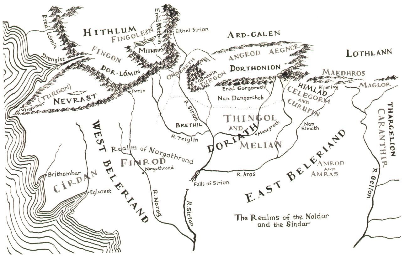
Chapter Fourteen: Of Beleriand and its Realms
“This is the fashion of the lands into which the Noldor came, in the north of the western regions of Middle-earth, in the ancient days…”
This chapter is essentially a description of a map that details how the Eldar divided up Beleriand. I would not recommend trying to read this chapter without looking at the map. This chapter would’ve served best as an appendix, so don’t spend too much time dwelling on every minor detail if this is your first time reading The Silmarillion. Below are a few online resources to help understand this map a bit better.
Resources for this Chapter:
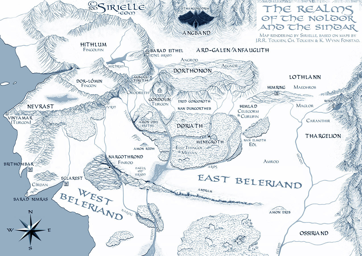
“Beleriand - Realms” by Sirielle on DeviantArt. Shared with permission
The River Sirion divided Beleriand into two parts: East and West Beleriand.
North:
Morgoth’s domain: Utumno, the Ered Engrin (“Iron Mountains”), Angband (“Hells of Iron”), and the towers of Thangorodrim. Filled with filth and desolation.
West Beleriand:
West of the River Sirion
Hithlum
Hithlum, which was fair but cold. This area was held by Fingolfin and Fingon. Fingon was given dominion over Dor-lómin.
Nevrast: Turgon
held by Fingolfin’s son Turgon (before he went to Gondolin)
Nargothrond: Finrod Felagund
“To the west lay the realm of Nargothrond—which extended from Sirion to the sea except for the Falas, kept by Círdan, close in friendship with Finrod—and was ruled by Finrod Felagund.”
Brithombar: Cirdan
East Beleriand:
East of the River Sirion
Ard-Galen
was the wide green plain that lay between Dorthonion and Angband. Ultimately this region was destroyed by the Dagor Bragollach (“Battle of the Sudden Flame”) in which Morgoth sent forth fire and poisonous fumes from Angband and destroyed this area. After this, it was called Anfauglith.
Dorthonion: Angrod and Aegnor
To the east of Dorthonion:
Maedhros held the northernmost realm in the March of Maedhros.
Doriath: Thingol and Melian
which lay within the Girdle of Melian and into which no one could pass against King Thingol’s will.
Eastern Belerian: Amrod and Amras
Lothlann: Maedhros and Maglor
Himlad: Celegorm and Curufin
Thargelion: Caranthir
South:
Ossiriand: land of the Green Elves
“In Eastern Beleriand, from the north, flowed the river Gelion, which split into the seven rivers after which Ossiriand—the Land of the Seven Rivers—was named. Ossiriand was bordered in the East by the Blue Mountains (Ered Luin/Ered Lindon). In Ossiriand, the Green Elves (Laiquendi) lived, and the Noldor named the mountains Ered Lindon after the sound of their singing.”
Key Quote:
"But after the coming of the Sun rich grass arose there, and while Angband was besieged and its gates shut there were green things even among the pits and broken rocks before the doors of hell."
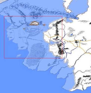
Beleriand (marked in red) during the time of The Lord of the Rings.


